Volcano Circle Tour: Grindavík, Reykjanes Lava Fields & Hot Springs

🏷️ Price from: 15.000 ISK

Explore the dramatic, volcanic landscapes and raw geothermal power of the Reykjanes Peninsula.

Discover the raw and unpredictable power of Icelandic nature on this 7-hour guided tour of the Reykjanes Peninsula. Marked by intense geological activity, this region is home to Iceland’s youngest lava fields, bubbling geothermal areas, and jagged coastlines.

A central part of this tour is a visit to the fishing village of Grindavík, beautifully situated but recently impacted by a series of powerful earthquakes and volcanic eruptions. You will witness firsthand how the landscape has been reshaped, with split roads and vast new lava fields. Combined with stops at historic lighthouses, colored geothermal fields, and the shifting tectonic plates, this tour offers a profound insight into the ever-changing forces beneath our feet.

Itinerary Highlights

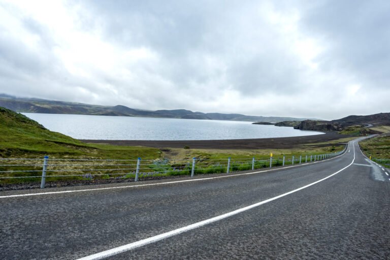
  • Lake Kleifarvatn: Enjoy a scenic drive along the shores of the largest lake on the peninsula, which famously drained 20% of its water into a subterranean fissure following an earthquake in the year 2000 before eventually refilling.
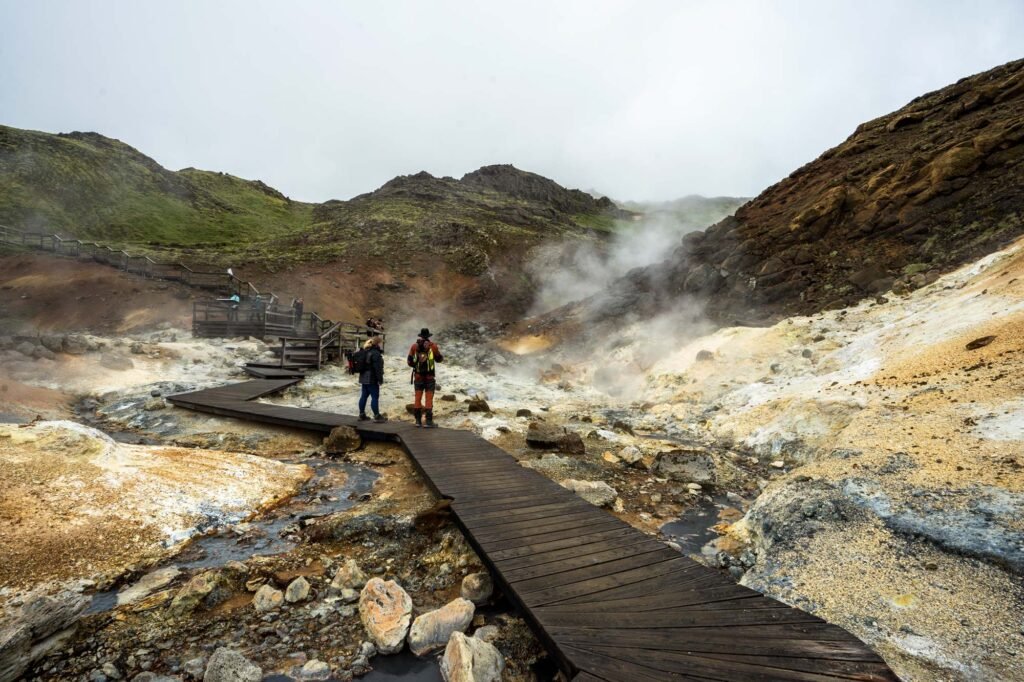
  • Seltún Geothermal Area: Walk among volcanic fumaroles, bubbling mud pots, and hot springs in a vibrant landscape painted red, yellow, and green by interacting minerals and sulfur.
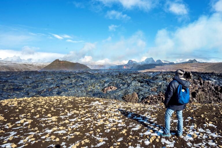
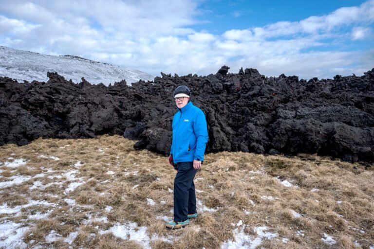
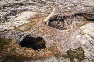
  • Nátthagi Lava Field: Get up close to the recent lava flows from the Fagradalsfjall volcanic system—the youngest land in Iceland.
  • Grindavík Town: See the visible impacts of recent natural disasters in this evacuated fishing village, where ongoing geological forces have caused significant damage and altered the terrain.
  • Gunnuhver Mud Pool: Visit Iceland’s largest mud pot, named after a local legend of a ghost trapped in the boiling thermal waters over 400 years ago.
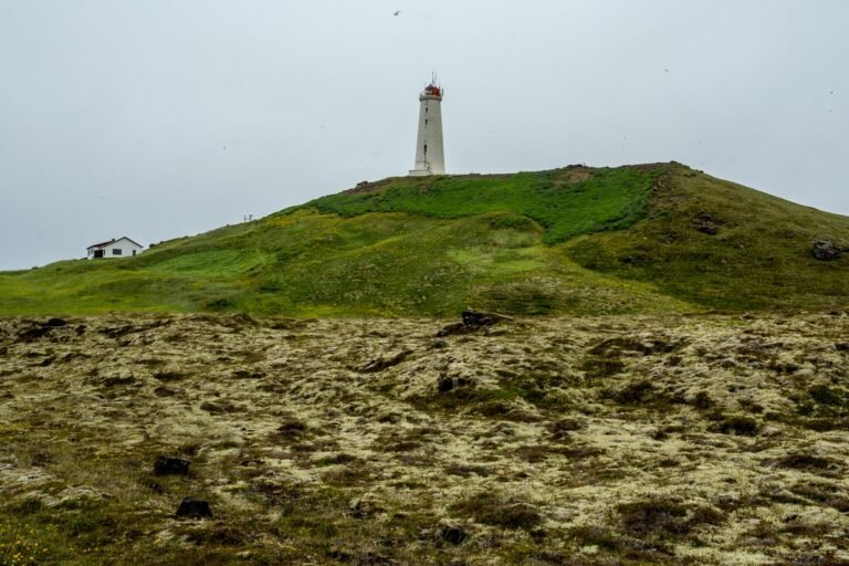
  • Reykjanesviti Lighthouse: Admire Iceland’s oldest lighthouse, standing proudly on the rugged coastline.
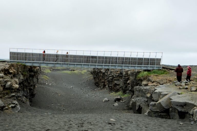
  • Bridge Between Continents: Walk across a small footbridge that spans a major fissure marking the divergence of the Eurasian and North American tectonic plates.

What’s Included

  • Transfer to and from designated stops in Reykjavík
  • English-speaking guide
  • Free WiFi on the bus

What’s Not Included

  • Food, drinks, and meals (There will be stops where you can purchase items)

What to Bring

  • Clothing: Warm outdoor layers, water- and windproof outerwear, a hat, and gloves or mittens.
  • Footwear: Comfortable and sturdy walking shoes.
  • Accessories: Camera or smartphone to capture the dramatic landscapes.

Good to Know

  • Duration: Approximately 7 hours.
  • Difficulty: Easy.
  • Volcanic Activity & Itinerary Changes: The Reykjanes Peninsula, especially around Grindavík, is highly active. Should volcanic activity or authorities cause area closures, the itinerary will be adjusted for your safety, and the guide will take you to the next available and accessible viewpoints.
  • Pickup Logistics: Pickup starts 30 minutes before your scheduled departure time. Since commercial buses are restricted from certain inner-city streets, please be prepared to meet at the nearest designated Tour Bus Stop.
  • Health & Accessibility: The tour is not wheelchair or stroller accessible and is not recommended for individuals with severe heart conditions.
  • Age Requirement: The minimum age for participants is 12 years old.

Cancellation Policy

  • Free cancellation: Cancel up to 24 hours in advance for a full refund.
  • Cancellations made less than 24 hours before the departure time are non-refundable.
Itinerary

The Lake Kleifarvatn
Kleifarvatn is the largest lake on the Reykjanes peninsula and a sight to behold. The road along the lake is probably one of the most under rated tourist roads int the country which hugs the lake’s shore. The tall mountains on the other side, make the drive alongside the lake nearly as fun as stopping to admire it from various vantage points. Fun Fact: In the year 2000, Kleifarvatn lost 20% of its water, when a fissure opened after an earthquake. The water drained into the nearby North Atlantic ocean through a subterranean channel. It has since recovered almost entirely.

The Geothermal area Seltún
On the fissure zone between 2 tectonic plates running across Iceland lies the large geothermal area of Krýsuvík. Within this area is Seltún, a geothermal field, where volcanic fumeroles, mud pots and hot springs have formed. The result of the geothermal activity is a landscape seemingly painted bright yellow, red and green; a result of sulfur interacting with the other minerals in the soil.

The Lava Field in Nátthagi
Here you will see the most recent lava fields created by the volcano at Fagradalsfjall. This is the youngest land in Iceland and can sometimes be alive with molten rock and lava.

Grindavík the Fishing Village
Grindavík, a small fishing town on the Reykjanes Peninsula, has faced significant natural disasters in recent months due to ongoing volcanic activity. Since late 2023, a series of powerful earthquakes and eruptions have forced evacuations, damaged infrastructure, and reshaped the landscape. The town remains largely abandoned, with roads split, homes destroyed, and the ground continuing to shift. Despite the devastation, scientists closely monitor the region, and emergency responders work tirelessly to manage the situation. This unfolding event highlights Iceland’s ever-changing nature and the raw power of the forces beneath our feet.

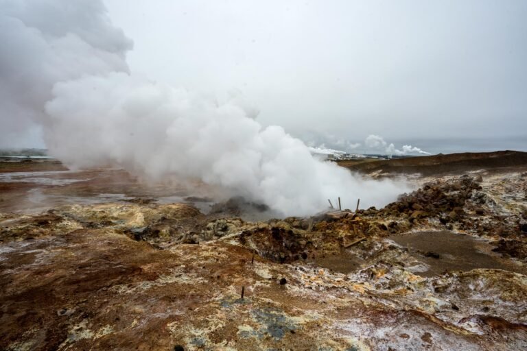
The largest mud pool in Iceland, Gunnuhver
Not far from Grindavik, Gunnuhver is an area of mud pools and steam vents on the very tip of the Reykjanes peninsula. The gases spewing from the ground make the surrounding lava rock into bubbling clay and the water to acid. Gunnuhver is the largest mud pot in Iceland. The area was named after a local ghost, Gunna, who was said to be causing trouble in the area until the local priest trapped her and she fell into the hot spring some 400 years ago. Scary!

ReykjanesvitiThe Lighthouse
On Reykjanes there are  many lighthouses. Some even say that the lighthouses outnumber the villages. The most famous of them all, as well as being the oldest one in Iceland, is Reykjanes lighthouse, which stands 29 meters (95ft) tall 69 meters (226 ft) above sea level.

The Bridge between continents
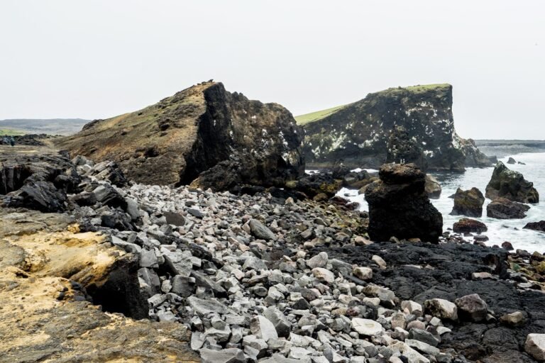
Bridge between Europe and North America on Reykjanes Peninsula. The lava-scarred Reykjanes peninsula lies on one of the world’s major plate boundaries, the Mid Atlantic Ridge. According to the continental drift theory the Eurasian and North American tectonic plates are continuously drifting apart with great forces under the gaping rifts. As the plates diverge, linear fractures, known as fissures form due to stresses created by the tension that builds up as the plates move away from each other. The Bridge between two continents at Sandvík is a small footbridge over a major fissure which provides clear evidence of the presence of a diverging plate margin. The bridge was built as a symbol for the connection between Europe and North America.

Weather & Travel Conditions

Weather conditions can change quickly no matter where you travel. To help you plan the best possible trip, every booking on Bookin.city includes 1 year of free Premium access to Vedur.app – featuring AI-powered forecast insights and weather information worldwide.

Simply send us an email with your booking details after confirming, and we’ll activate your free Premium subscription!

🕒 Duration: hours
🌍